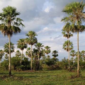
Mato Grosso ecosystems
Mato Grosso is one of the largest states of Brazil, located in the western part of the country. This Brazilian state contains three main ecosystems: the Cerrado, the Pantanal and the Amazon rainforest.
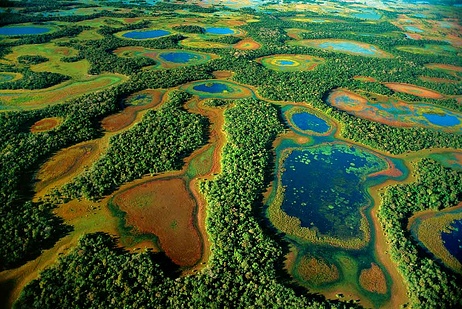
Pantanal Conservation area
The Pantanal is a natural region of 140,000-195,000 square kilometres located in two Brazilian states (Mato Grosso do Sul, Mato Grosso) with portions in Bolivia and Paraguay. This ecosystem was listed by UNESCO as a Natural World Heritage Site in 2000 as it is the world’s largest tropical wetland area, and the world’s largest flooded grasslands.
Roughly 80% of the Pantanal floodplains are submerged during the rainy seasons (1,320 mm/year), nurturing a biologically diverse collection of aquatic plants and helping to support a dense array of animal species.
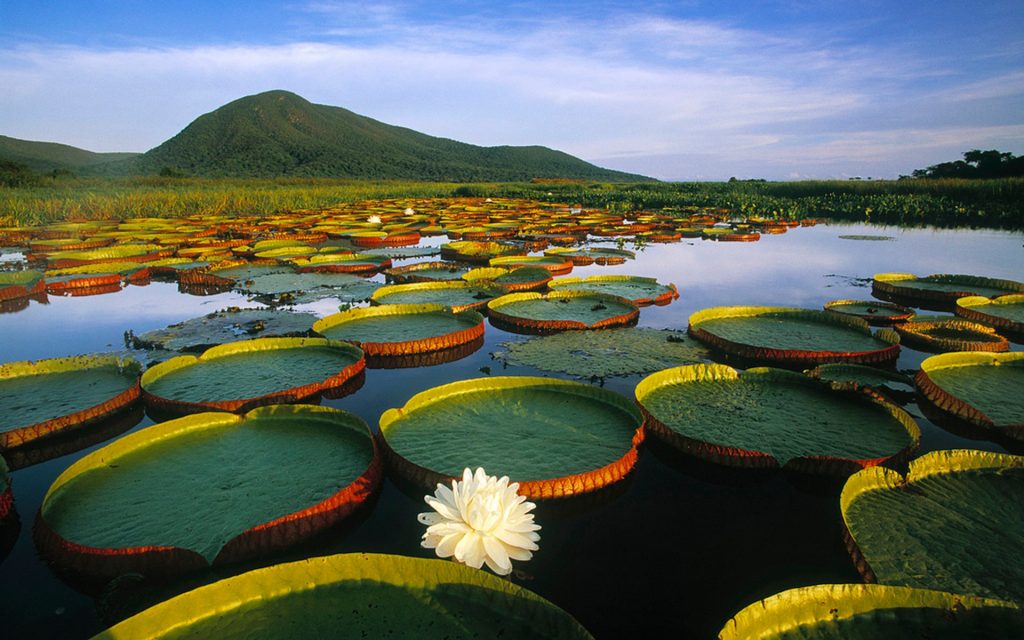
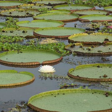
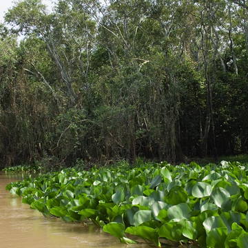
Flora
The vegetation of the Pantanal, often referred to as the “Pantanal complex”, is a mixture of plant communities typical of a variety of surrounding biome regions: these include moist tropical Amazonian rainforest plants, semiarid woodland plants typical of northeast Brazil, Brazilian cerrado savanna plants and plants of the Chaco savannas of Bolivia and Paraguay. Approximately 2,000 different plants have been identified in the Pantanal biome, with some presenting significant medicinal promise.
Fauna
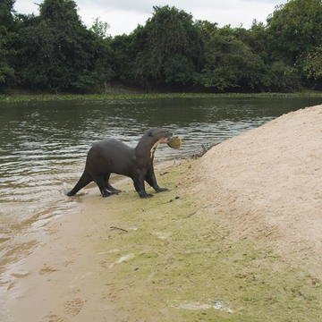
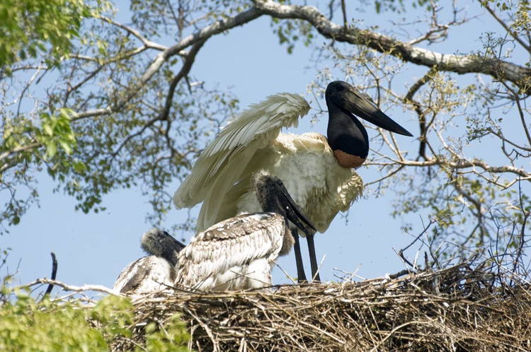
The Pantanal ecosystem is also home to 463 bird species, 269 fish species, more than 236 mammalian species, 141 reptile and amphibian species, and over 9,000 subspecies of invertebrates. Among the rarest animals to inhabit the wetland of the Pantanal are the marsh deer and the giant river otter. Parts of the Pantanal are also home to the following endangered or threatened species: the hyacinth macaw bird, the crowned solitary eagle, the maned wolf, the bush dog, the South American tapir, and the giant anteater.
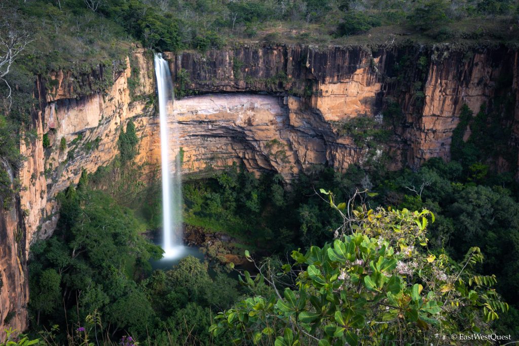
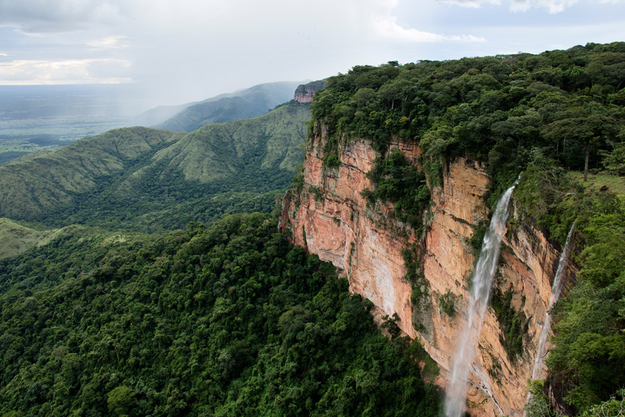
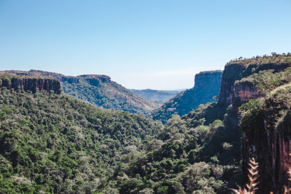
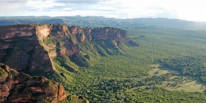
Chapada dos Guimarães National Park
The Chapada dos Guimarães National Park in Mato Grosso is a unique environment of 33 square kilometres of sandstone mountains with dramatic cliffs and waterfalls. It is the state main touristic attraction as it is a beautiful ecological site with dozens of cascades, mountain peeks, caves and trails in the Cerrado vegetation, known as the Brazilian savanna. The Chapada dos Guimarães National Park was established in 1989 with the purpose to protect the local ecosystems and to ensure the preservation of natural and archaeological sites, while supporting appropriate use for visiting, education and research.
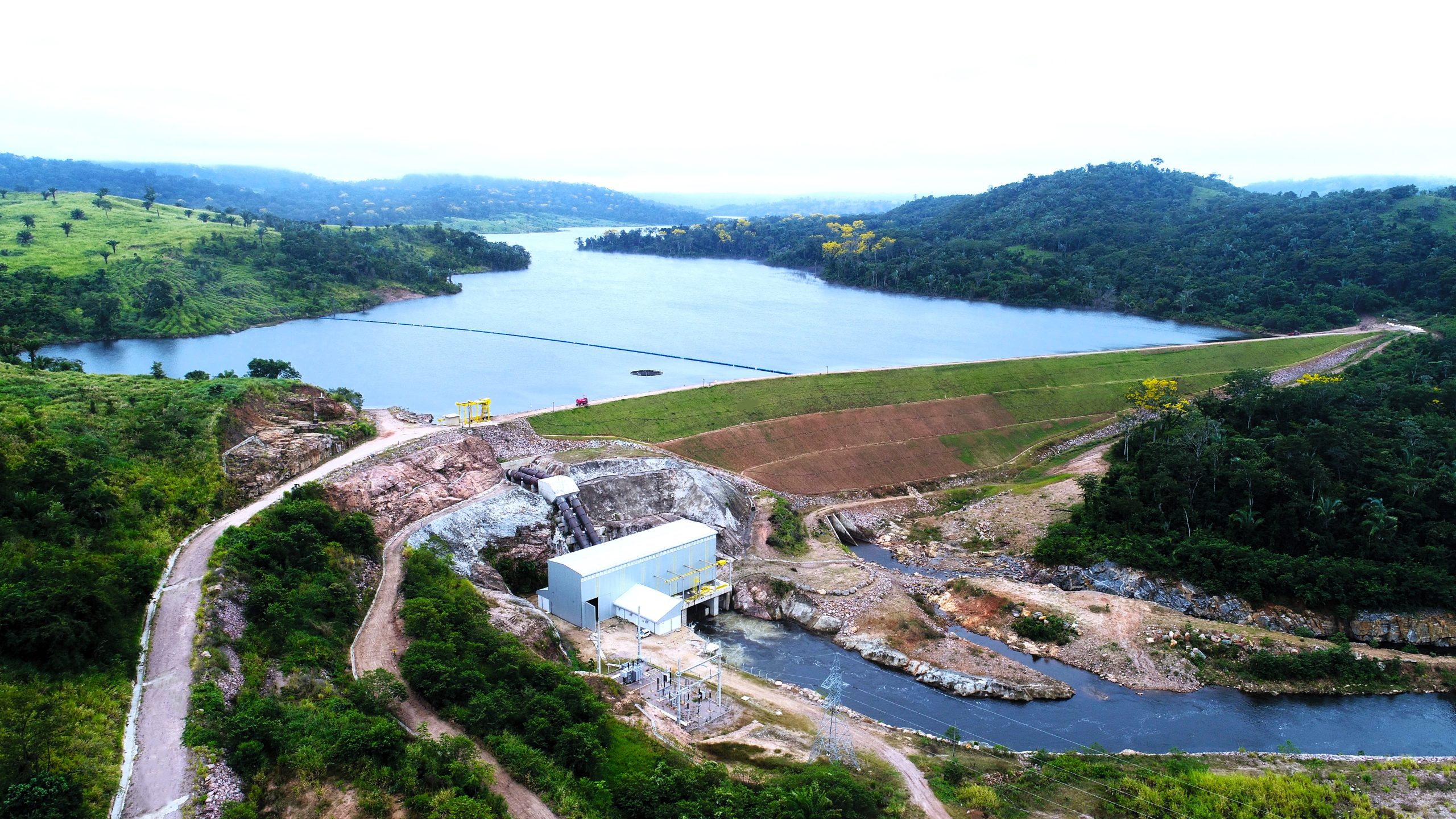
Guaporé River
The Guaporé river, known in Bolivia as the “Rio Iténez”, is a river that is a part of the Amazon river basin. It borders the states of Mato Grosso and Rondônia and the Bolivian departments of Santa Cruz and Beni, serving as the border between the 2 countries, Brazil and Bolivia.
The Guaporé river originates from the encounter of the Moleque river, the Sepultura river and the Lagoazinha river in the “Chapada dos Parecis –, at an altitude of 630 meters. It has its estuary on the Marmoré river, where it enters into Brazilian territory.
The Guaporé river has a length of 1,716 km, of which 1,150 km are navigable from Vila Bela da Santíssima Trindade (along its entire route in the state of Rondônia, and a small part of Mato Grosso, where is runs in an east-west direction). This navigable section includes the border between Brazil (north bank) and Bolivia (south bank).
Chapada dos Parecis
Chapada dos Parecis is a Brazilian relief formation located in the central region of South America, and in the Southwest of the state of Mato Grosso, close to the border with Bolivia. From the relief formation, two larger river basins are formed; one side of the Amazon basin, from the Gauporé river, Culuene river, Papagaio river and others, and, the north part of the Platina basin, which later integrates into the Paraná basin, thus forming the Platino system.
Chapada dos Parecis is bathed by numerous waterfalls and crystal clear waters, which can be accessed from Tangará da Serra, a medium-sized regional city. A large part of the waterfalls and rivers are located in indigenous lands, which, demarcated by Funai, in many cases represent the few areas not yet deforested for the cultivation of soybeans or sugarcane on an industrial scale in the region.
Despite ancient relations with the Brazilian Federal State, many indigenous people were incorporated into the “Comissão das Linhas Telegráficas”, commanded by Rondon since the end of the 19th century. The toponymy “Parecis” is due to the original occupation of the Aruaque-speaking Paresis Indians, who was referred to as “Bearers of Many Principles of Civility”. The name was established in 1748, when the governor of the province of Cuiabá and the State of Mato Grosso was created and appointed.